Our Services
↓
Our Services
↓
Our Services
↓
At Survey Mark, we provide the critical data that shapes developments, informs decisions, and ensures accuracy at every stage. From cadastral boundaries to complex engineering works and advanced spatial mapping, our expertise spans the full spectrum of land surveying.
At Survey Mark, we provide the critical data that shapes developments, informs decisions, and ensures accuracy at every stage. From cadastral boundaries to complex engineering works and advanced spatial mapping, our expertise spans the full spectrum of land surveying.
At Survey Mark, we provide the critical data that shapes developments, informs decisions, and ensures accuracy at every stage. From cadastral boundaries to complex engineering works and advanced spatial mapping, our expertise spans the full spectrum of land surveying.
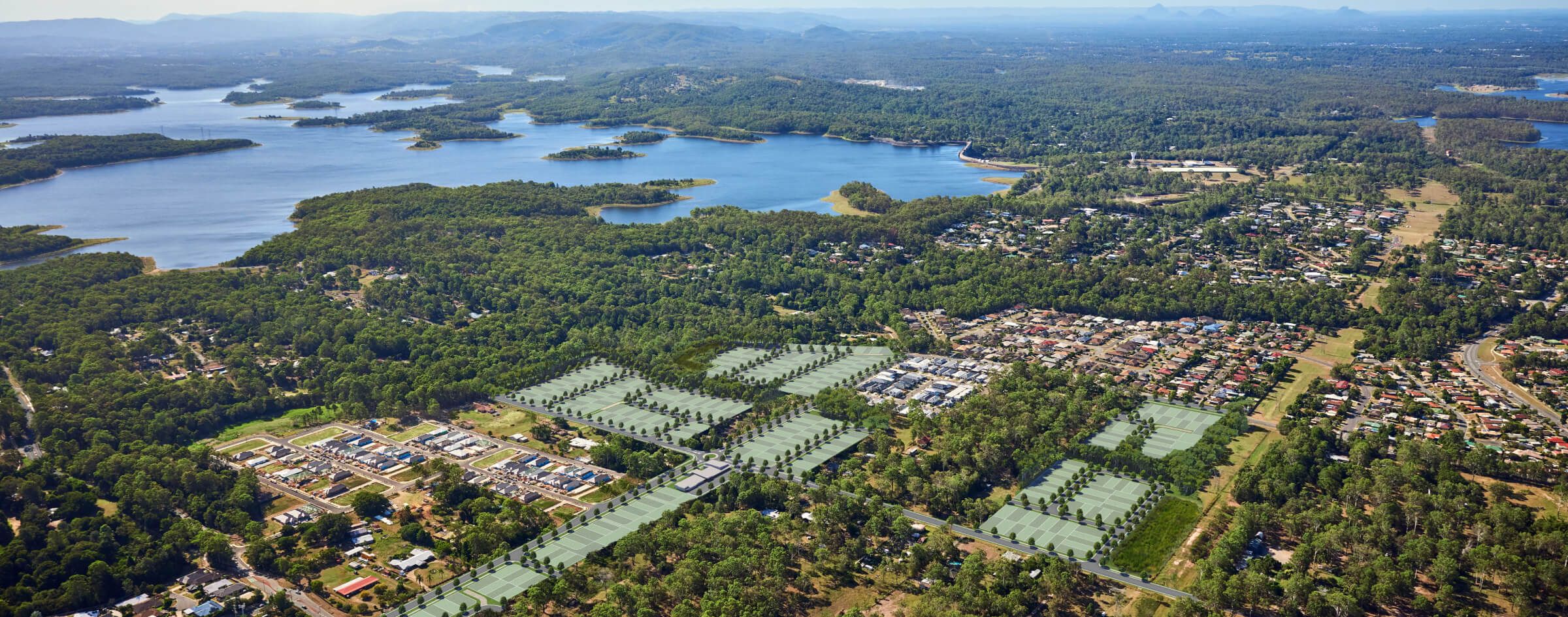
Cadastral surveying is the cornerstone of land development, establishing legal property boundaries with precision and ensuring compliance with regulatory frameworks. Whether subdividing land, securing titles, or verifying boundaries, accurate cadastral data is essential for smooth transactions and future development.
Cadastral surveying is the cornerstone of land development, establishing legal property boundaries with precision and ensuring compliance with regulatory frameworks. Whether subdividing land, securing titles, or verifying boundaries, accurate cadastral data is essential for smooth transactions and future development.
Our cadastral surveying services include:
Greenfield Land Subdivisions – Defining and subdividing undeveloped land for new projects.
Infill Land Developments – Surveying and subdividing land in established urban areas.
Community Title Developments – Establishing community schemes for shared property ownership.
Tenure and Titling Strategy – Developing strategies to manage land tenure and titling issues.
Boundary Identification – Precisely identifying and marking property boundaries.
Commercial Building Leases – Defining lease boundaries for commercial properties.
Plan Sealing – Preparing and submitting survey plans for official approval.

Engineering surveying provides the spatial data needed to guide construction and infrastructure projects from planning through to completion. It ensures accuracy in design, site preparation, and structural positioning, minimising costly errors and improving project efficiency.
Engineering surveying provides the spatial data needed to guide construction and infrastructure projects from planning through to completion. It ensures accuracy in design, site preparation, and structural positioning, minimising costly errors and improving project efficiency.
Our engineering surveying services include:
3D Contour and Detail – Mapping topography and site features in 3D for accurate design.
Establish Site Control – Setting up reference points for project accuracy.
Civil Setout – Marking out key infrastructure features for construction.
Building Setout – Precisely marking building positions for construction.
As Constructed – Documenting the final construction as-built data.
ADAC Data Submission – Submitting As-Constructed Data to authorities for compliance.
Deformation Monitoring – Monitoring structural movements over time to ensure safety.

Spatial surveying captures, analyses, and visualises the built and natural environment with unprecedented accuracy. Using cutting-edge technologies like UAVs, laser scanning, and photogrammetry, we provide detailed 3D data for planning, design, and decision-making.
Spatial surveying captures, analyses, and visualises the built and natural environment with unprecedented accuracy. Using cutting-edge technologies like UAVs, laser scanning, and photogrammetry, we provide detailed 3D data for planning, design, and decision-making.
Our spatial surveying services include:
Photogrammetry – Creating detailed maps and models from aerial images.
UAV (Drone) Surveys – Using drones to capture high-resolution imagery and data.
Laser Scanning – Capturing precise 3D data for complex structures and environments.
Slope Analysis – Analysing terrain for stability and design considerations.
Mapping – Creating accurate geographic representations for planning and development.
3D Revit Models – Generating 3D models for building design and visualisation.